AER Intel inspects critical infrastructure with enterprise drones, multi-sensor capture, and AI — no scaffolding, no rope teams, no downtime. Every survey becomes a precise digital baseline you can measure against for the life of the asset.
Critical infrastructure is usually inspected too late and too rarely. We use technology to change that — catching change before it becomes failure, and making rigorous inspection affordable enough to run on every asset, not only the ones already in trouble.
We see how a structure is changing while there is still time to act — not after damage forces a response.
Inspection this thorough has been reserved for crisis projects. We make it routine and affordable across an entire portfolio.
Decisions rest on measured, defensible data — exact widths, areas, and locations — instead of subjective field notes.
AER Intel is a one-of-a-kind provider of comprehensive condition assessment for critical infrastructure — combining sensors on enterprise-grade platforms with our own AI to read structures above and below the waterline. Our technology is developed in Germany and applied across projects in Germany and India, including acoustic testing methods engineered entirely in-house.
Remote platforms replace dangerous scaffolding and rope access. We capture visual, thermal, and acoustic data while your facility stays fully operational.
Each survey is an ultra-precise, millimetre-accurate snapshot — a definitive baseline for analysis, free of the noise and drift of always-on sensor feeds.
We translate massive field datasets into a single, clear health assessment using computer vision and modern informatics.
Advances in AI, vision, edge computing, and sensor fusion drive us toward fully automated inspection — safer, always-on, and extending asset life.
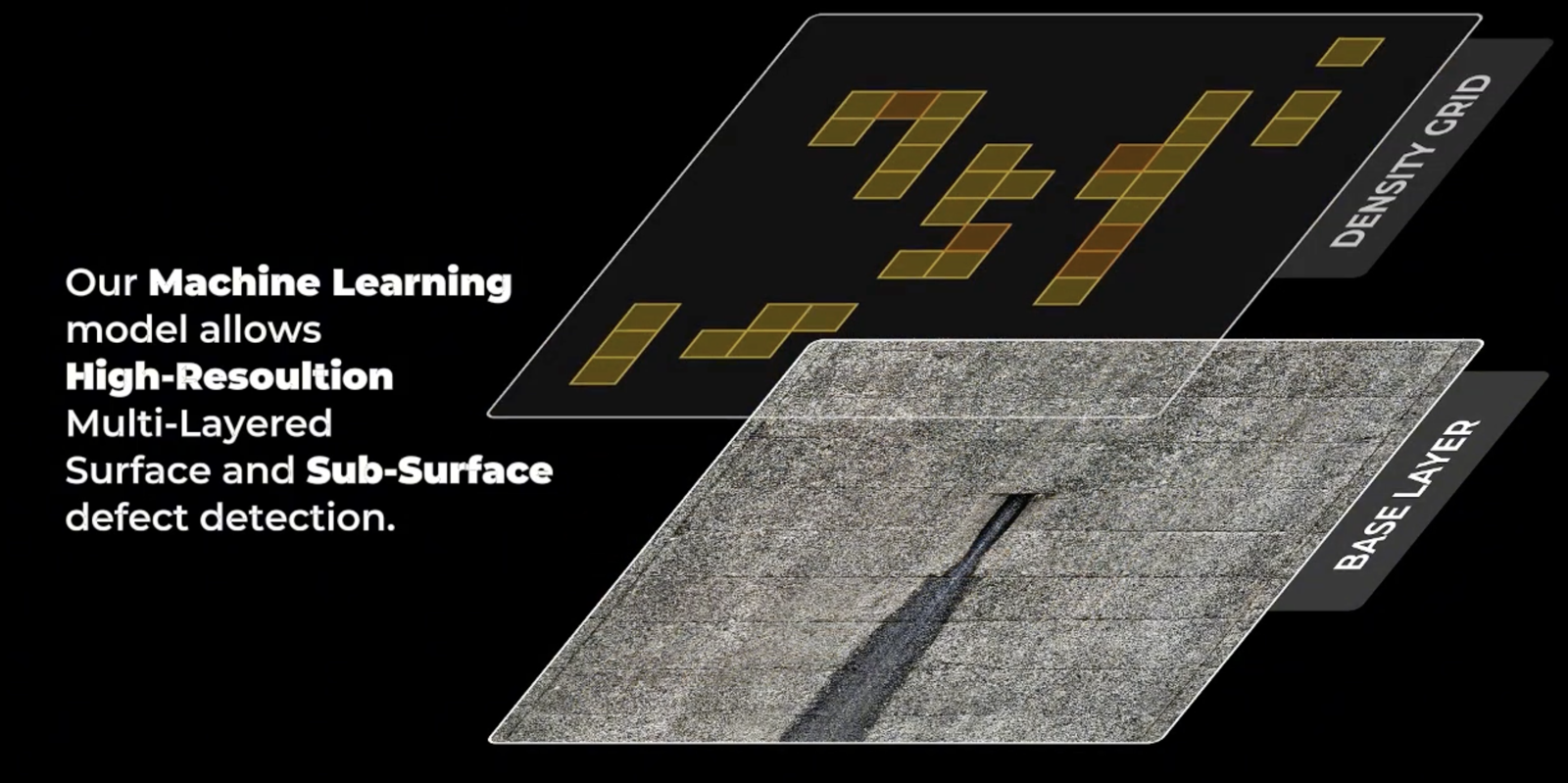
To build a complete digital twin, we deploy specialised platforms that read the full condition of a structure: the visible face, the hollow spots beneath it, and the parts hidden underwater.
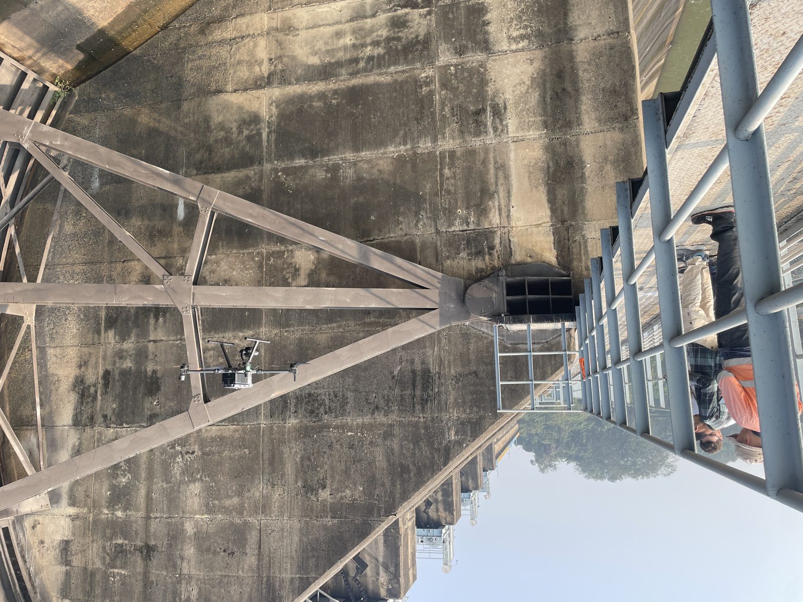
Professional drones build a true-to-life 3D model at 1 mm resolution — like examining the concrete from just over a metre away. High-resolution thermal imaging is captured alongside it, revealing water seepage through the concrete and heat from chemical reactions inside it.
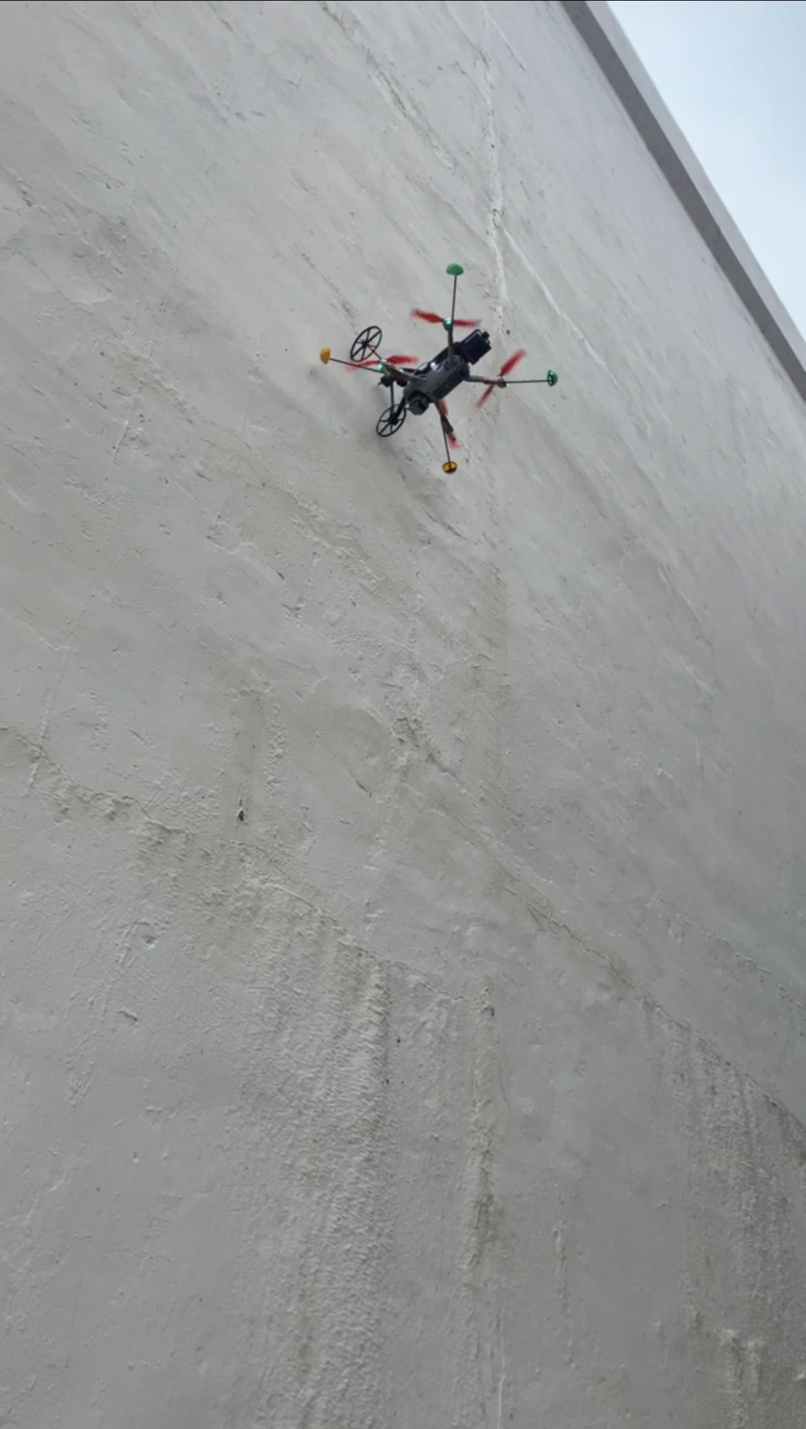
Drone-mounted acoustic sensors map tall vertical faces to reveal hollow zones and delamination hidden beneath the surface.
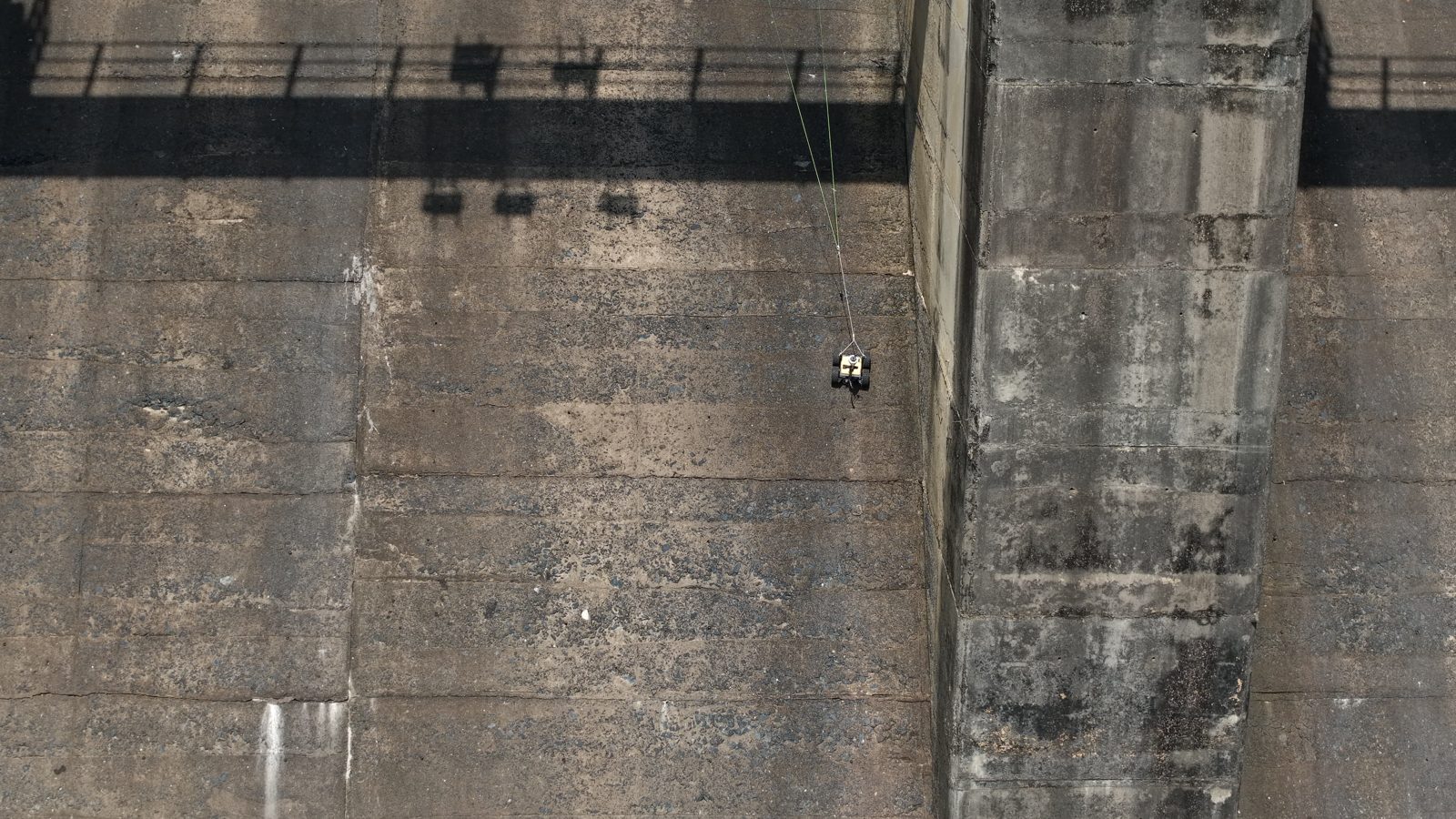
On steep spillways drones can't reach, tethered rovers traverse the face and collect a continuous acoustic record.
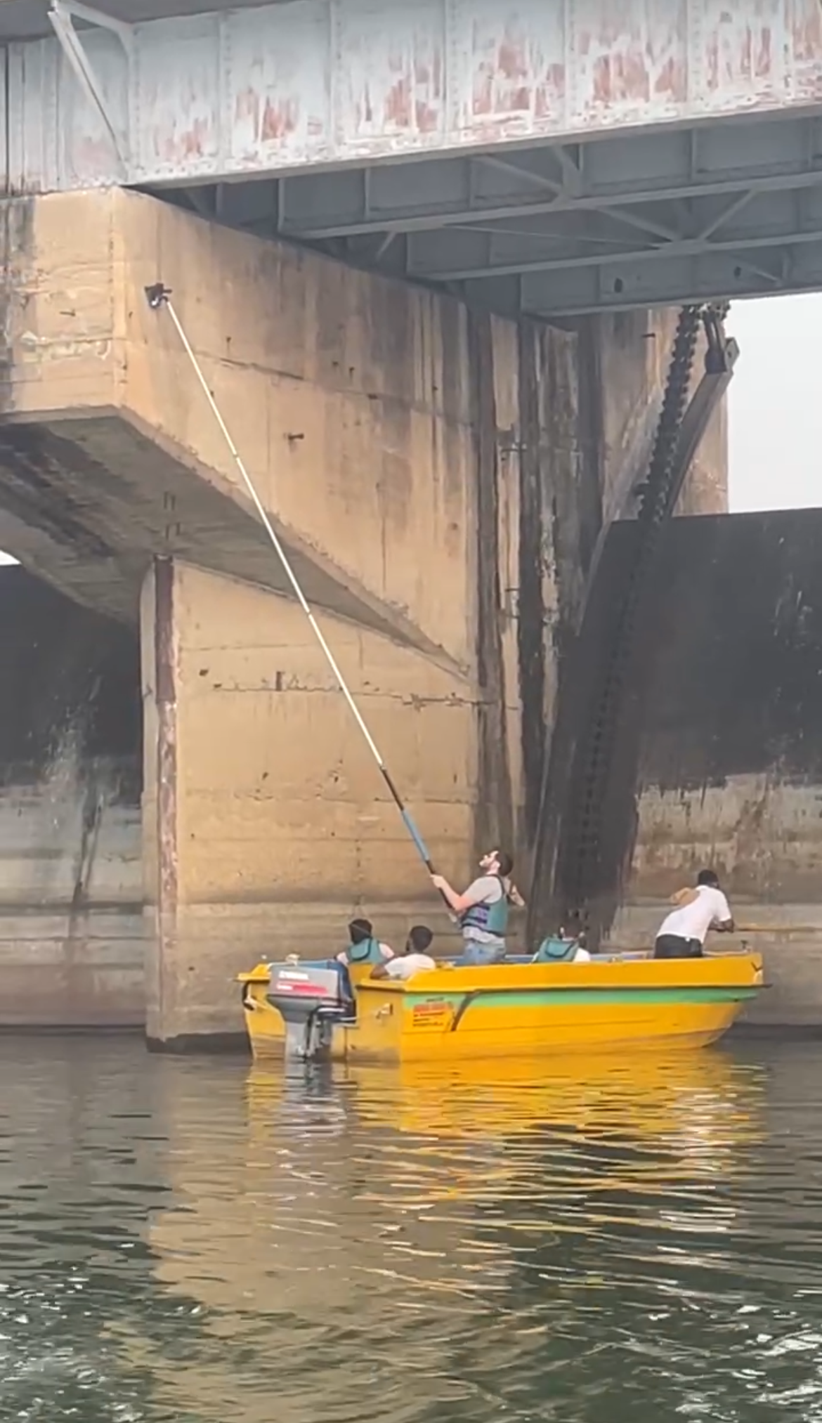
Near ground and water level, extended poles with acoustic sensors let our engineers assess every reachable zone in detail.
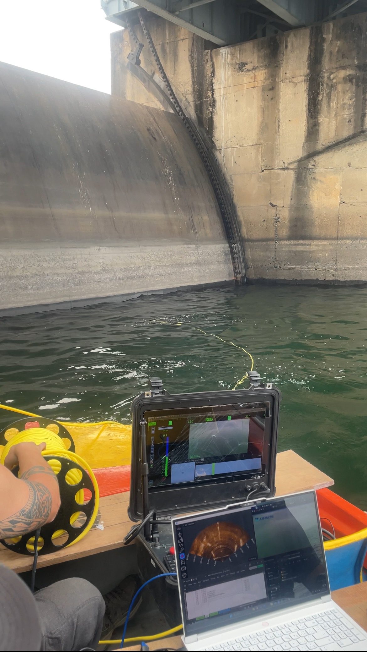
High-resolution sonar scans the submerged structure to build a precise 3D model of the underwater face at 0.5 mm resolution.
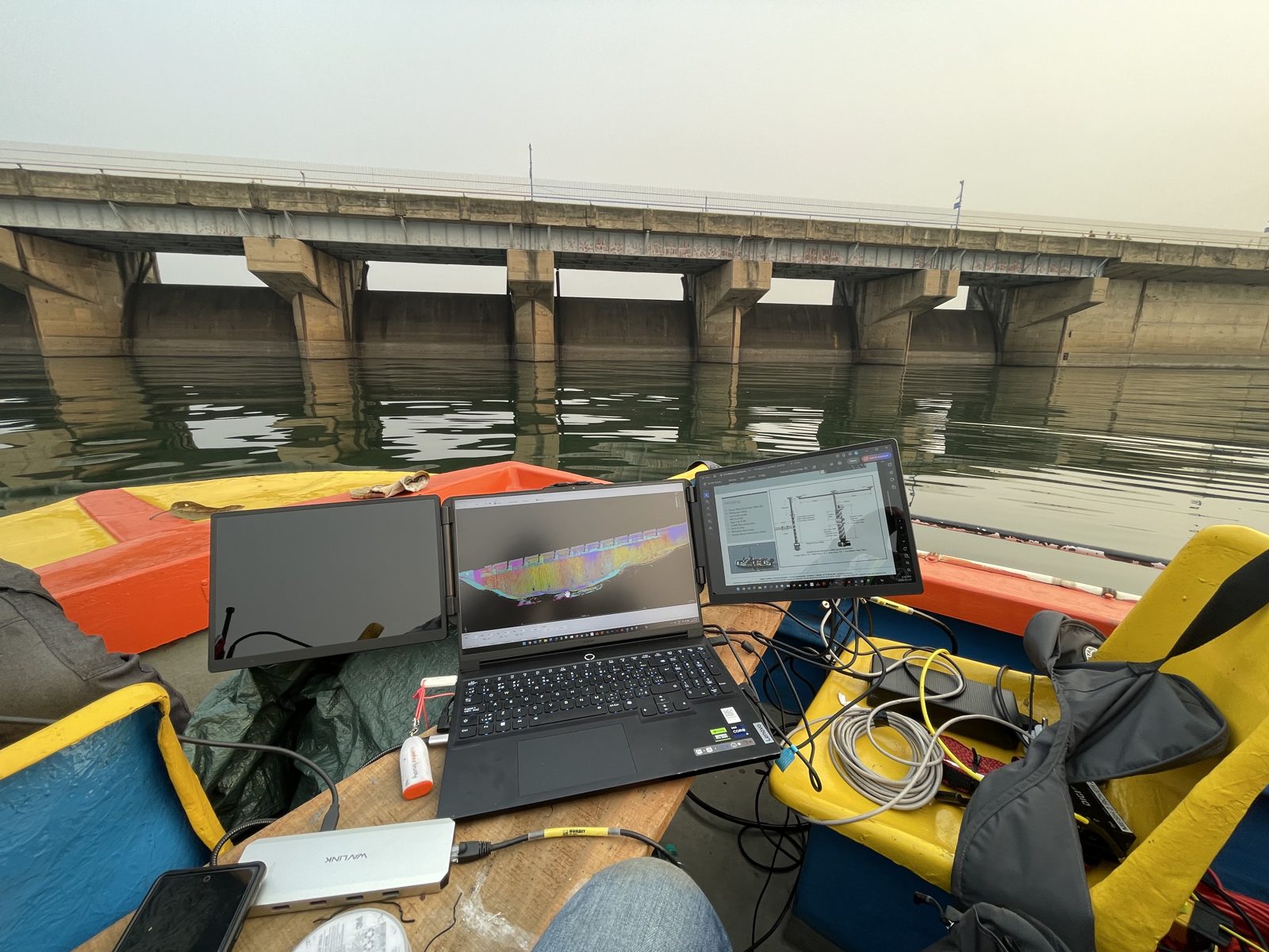
Sonar is deployed and monitored live from the surface, extending full-coverage inspection below the waterline.
Everything captured in the field flows into one environment, where it becomes measurable, comparable, and ready to act on.
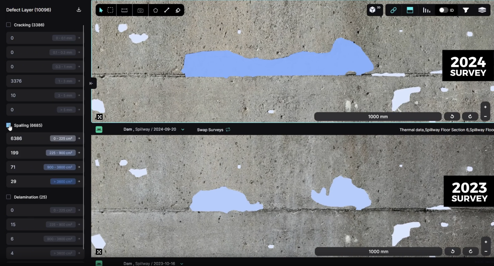
Data from every platform — aerial, rover, handheld, and sonar — lands in one place, fully geotagged as switchable layers.
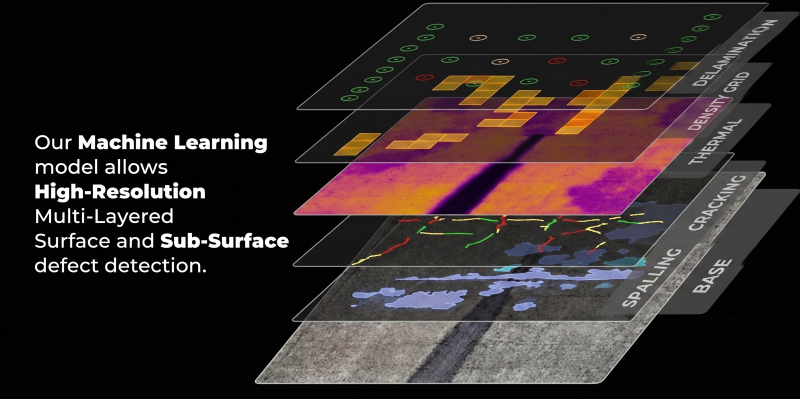
Machine-learning models find surface anomalies like cracks and spalling, and subsurface issues like delamination — automatically, across the entire face.
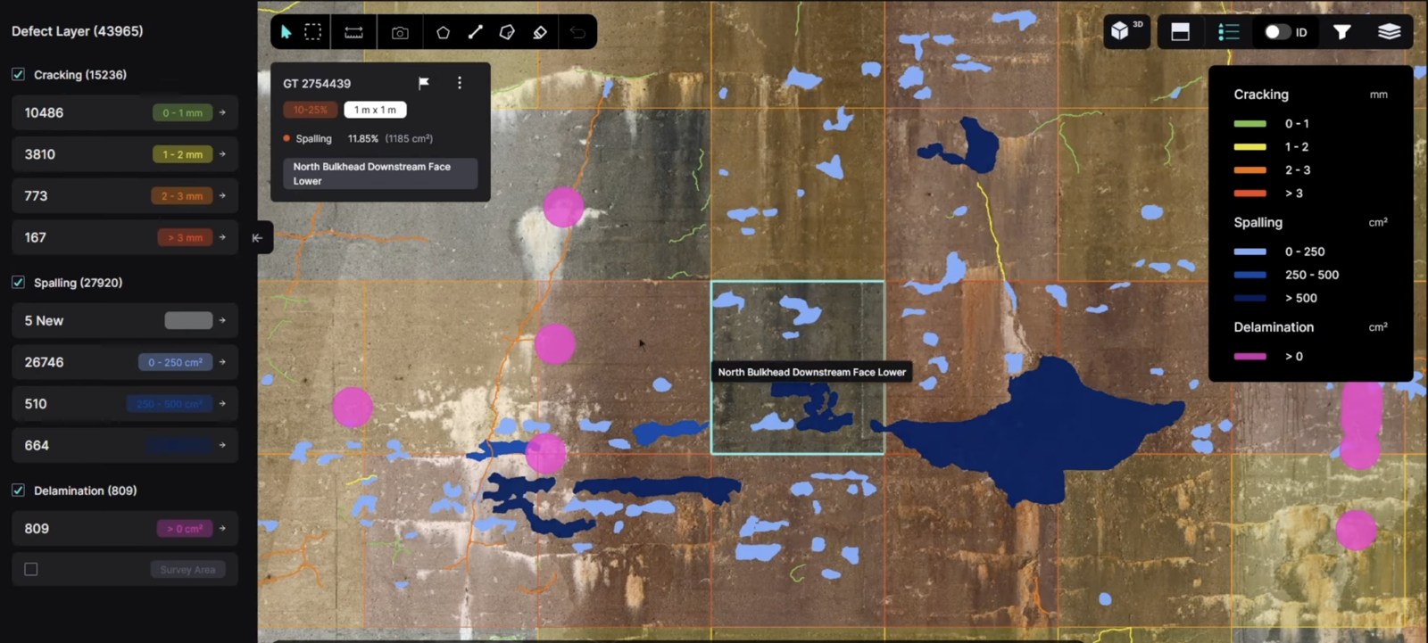
Every defect is indexed and measured — filtered precisely by length, width, and area — so nothing is left to estimation by eye.
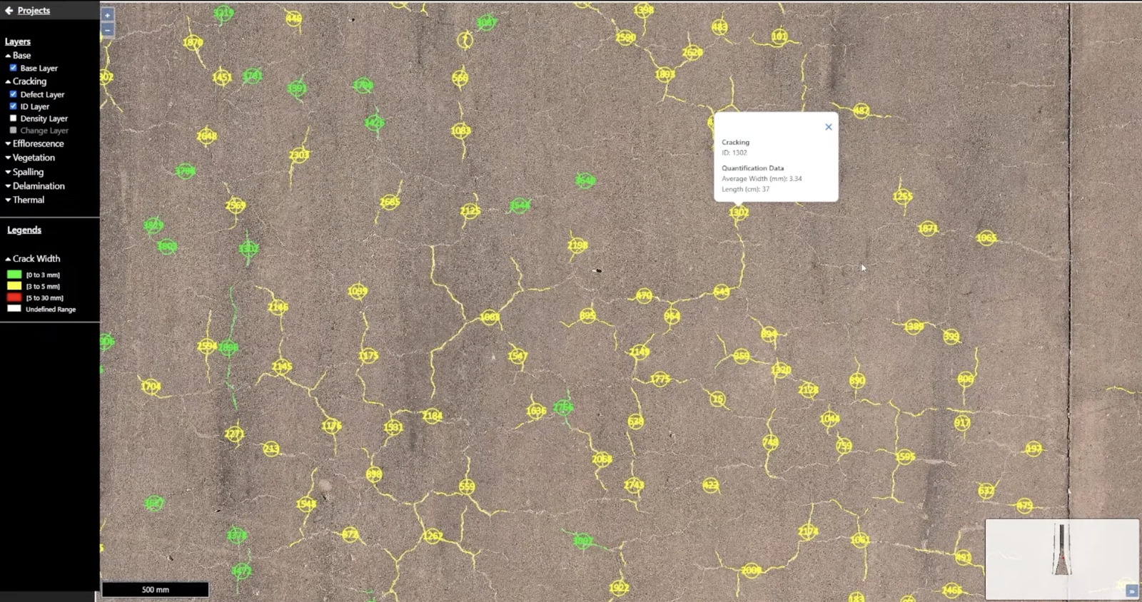
Grid overlays turn millions of data points into clear hotspots, so maintenance effort goes where it matters most first.
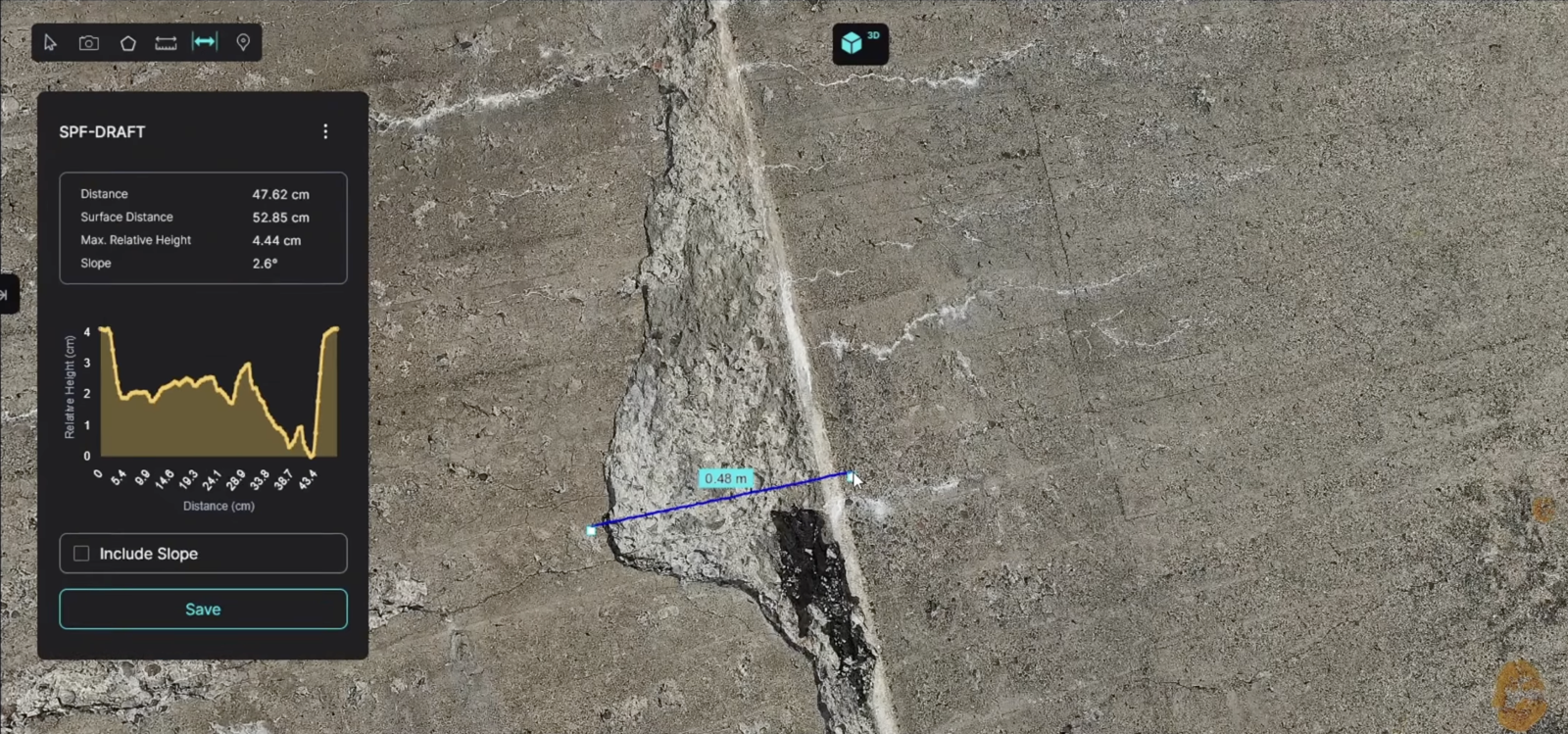
Teams navigate a full 3D model and measure exact distances and relative heights directly on the mesh — capturing slab shifts and crack offsets to the millimetre.
With a baseline in place, each new survey shows exactly what changed. The platform flags defects that persist, recur, or worsen — and quantifies how much.
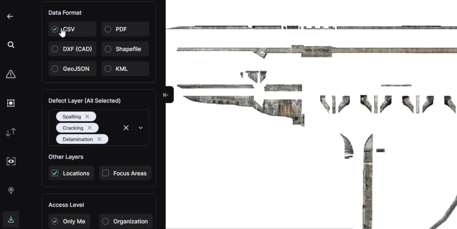
Every detected defect, measurement, and location tag exports straight into structured, CAD-ready formats. Your design team can move directly to quantities and repair planning — separating critical interventions from routine upkeep.
We're building the technology to maintain critical infrastructure predictively, at a cost that makes it possible everywhere. We'd welcome the chance to show ADANI exactly what that looks like on your assets.